Pages

Abandoned Mines on Route 66

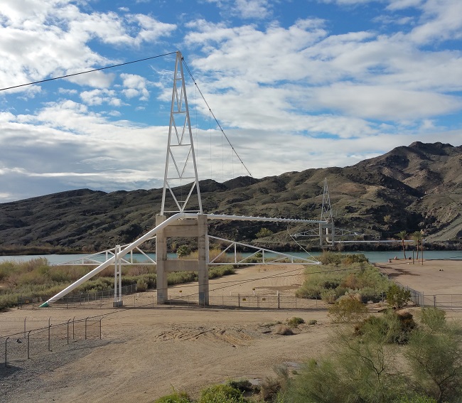
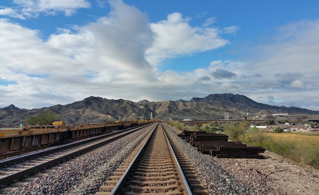
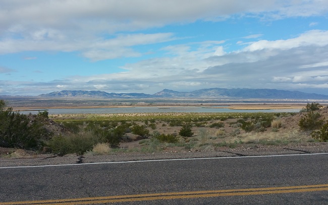
After crossing into Arizona I exited the I-40 and drove northward along a winding, mountainous stretch of Route 66 toward the mining ghost town of Oatman. It was a perfect day to enjoy Arizona's beautiful landscapes.

Exploring abandoned mines and beautiful desert landscape along Route 66 in Arizona

It had rained a bit in the early morning, and low clouds still hugged the mountains. 

Exploring abandoned mines and beautiful desert landscape along Route 66 in Arizona

Exploring abandoned mines and beautiful desert landscape along Route 66 in Arizona

Exploring abandoned mines and beautiful desert landscape along Route 66 in Arizona

Exploring abandoned mines and beautiful desert landscape along Route 66 in Arizona

Exploring abandoned mines and beautiful desert landscape along Route 66 in Arizona

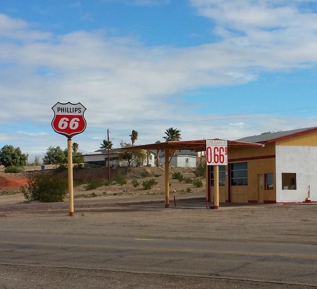
I passed a few interesting businesses along the way.

Exploring abandoned mines and beautiful desert landscape along Route 66 in Arizona

It's a shame gas prices aren't like this anymore:

Exploring abandoned mines and beautiful desert landscape along Route 66 in Arizona

I stopped to check out an industrial site that looked like it might be abandoned, but it wasn't. As a consolation prize, I got a pic of an old limo parked nearby. 

Exploring abandoned mines and beautiful desert landscape along Route 66 in Arizona

As I planned my route into Arizona the previous night, I realized I had only a week and a half before I needed to be back in L.A. I wouldn't have time to visit all the places I'd plotted on my Urban Exploration map, and would have to forgo the ones that were too far out of the way. Disappointing as it was, it will give me a great excuse to plan another urbex road trip sometime in the future.

There were so many interesting abandoned places in Arizona, I could easily have spent the rest of my trip there. But my sights were set on Deer Trail Colorado, the home of the only accessible Titan Missile silo complex, and one of the main reasons I took the road trip in the first place. And there were places I wanted to explore in New Mexico and Utah.

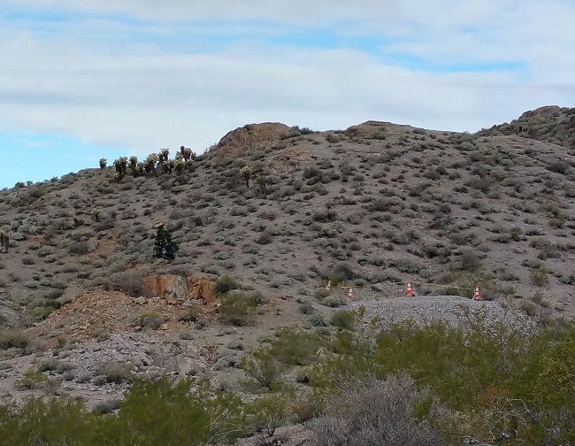
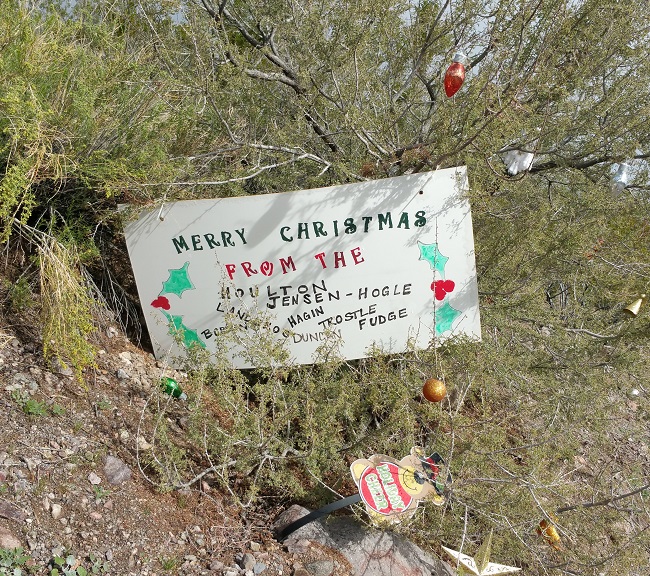
On the way to Oatman I saw a random Christmas tree on the side of a hill, so I stopped to investigate.

Exploring abandoned mines and beautiful desert landscape along Route 66 in Arizona

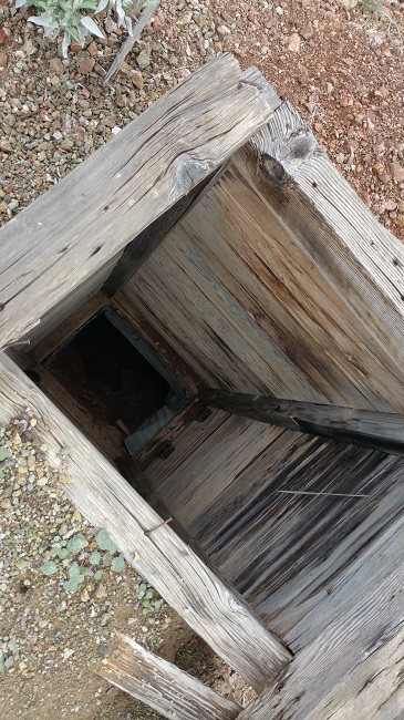
The tree stood directly behind a vertical mine shaft, which was unmarked and wide open. Yellow caution tape and orange cones surrounded another nearby shaft. Vertical mine shafts scare the heck out of me because they are usually very deep and narrow. The openings are even with the ground and easy to overlook if you're not watching where you're going. I thought about how a photographer, lining up a shot, might take a few steps backwards and end up tumbling into the abyss.


I stood atop the hill, looking out over miles of rocky terrain, when I noticed a distant heap of mine tailings (discarded fragments of rock that are left over after the valuable minerals have been separated out). Tailings are usually found in large heaps outside of the mines from which they were excavated. I hadn't seen any mines, other than the two by the Christmas tree, and hoped the tailings might lead me to a horizontal mine I could walk into.  

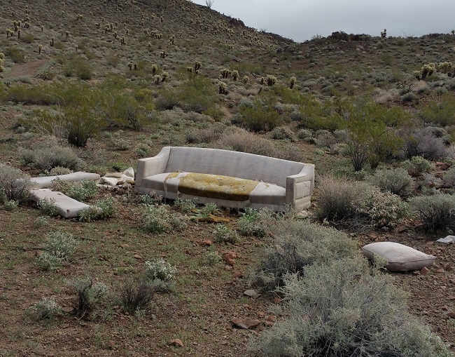
The tailing pile was much farther than it looked, and I climbed up and down some steep rocky hills to get to it. I happened upon a discarded couch, but resisted the urge to stop and rest. 

Exploring abandoned mines and beautiful desert landscape along Route 66 in Arizona

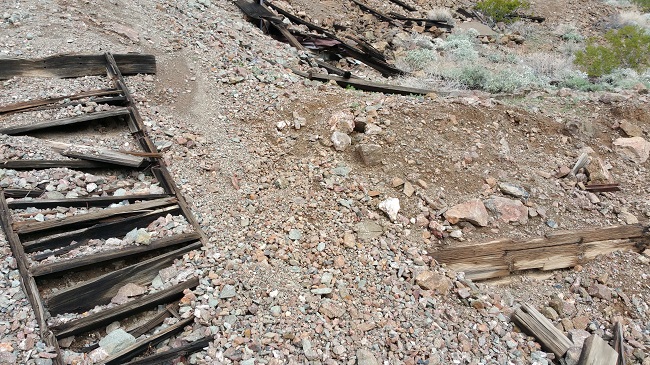
I reached the tailings and found that they came from another vertical mine shaft. 

Exploring abandoned mines and beautiful desert landscape along Route 66 in Arizona

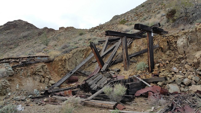
The site was littered with rusty metal scraps from long-gone equipment and the remnants of collapsed wooden support structures. 

Exploring abandoned mines and beautiful desert landscape along Route 66 in Arizona

The hill offered a good view of the surrounding area, including several more mines and a run-down homestead that appeared occupied. I climbed down the hill and saw signs warning people away from the homestead, but not the mines. Not wanting to get kicked off the land, I kept my distance. 

Exploring abandoned mines and beautiful desert landscape along Route 66 in Arizona

I was tired from crossing the rough terrain with the sun beating down on me, but my adrenaline was pumping so I roamed the countryside, determined to check out every mine within eye shot. Most were vertical shafts accompanied by the remains of wooden headframes and rusted metal junk.

Exploring abandoned mines and beautiful desert landscape along Route 66 in Arizona

Exploring abandoned mines and beautiful desert landscape along Route 66 in Arizona

Exploring abandoned mines and beautiful desert landscape along Route 66 in Arizona

Exploring abandoned mines and beautiful desert landscape along Route 66 in Arizona

Exploring abandoned mines and beautiful desert landscape along Route 66 in Arizona

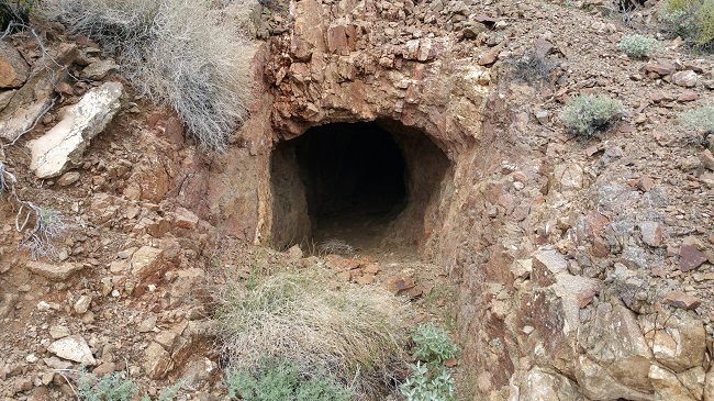
I found two horizontal mines and strolled through both of them. The first only went back about 20 feet. 

Exploring abandoned mines and beautiful desert landscape along Route 66 in Arizona

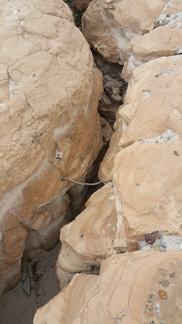
The second mine extended several hundred feet and connected with a tight vertical chasm I had seen earlier. 

Exploring abandoned mines and beautiful desert landscape along Route 66 in Arizona


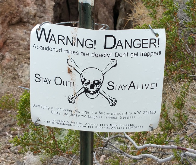
Near the end of my hike, I came to a mine with a warning sign posted at its entrance.

Exploring abandoned mines and beautiful desert landscape along Route 66 in Arizona

On the way back to the car, I passed a sign left by the same people who had put up the Christmas tree that caused me to stop in the first place. It was a fitting bookend to my hike. 

Exploring abandoned mines and beautiful desert landscape along Route 66 in Arizona

I also happened past a few wild burros. One stared at me, occasionally making loud noises, which I assumed were meant to intimidate me. I kept a respectful distance. There are many wild burros in the area, descended from those kept by miners as pack animals. 

Exploring abandoned mines and beautiful desert landscape along Route 66 in Arizona

I got back to the car and continued toward Oatman. To keep this post from getting ridiculously long, I'll tell you all about Oatman next week.

Thanks for checking out this article. If you enjoyed it, please feel free to share it on Facebook. While you're at it, please subscribe to Places That Were and follow me on my social media sites:

Facebook: http://www.facebook.com/placesthatwere

Google+: https://plus.google.com/u/0/+JimSullivanPlacesThatWere/posts

EyeEm: https://www.eyeem.com/u/placesthatwere

Instagram: http://instagram.com/theplacesthatwere

Twitter: https://twitter.com/placesthatwere/

Tumblr: http://placesthatwere.tumblr.com/

Youtube: https://www.youtube.com/jimplicit

500px: https://500px.com/placesthatwere

Thank you!
The Dying City of Needles, California

Urban exploration of the dying town of Needles, CA along Route 66

The adrenaline rush from exploring Amboy had ended, and I was ready to grab a bite to eat and then hit the hay. Since Roy's Cafe no longer had a functioning kitchen, I hadn't eaten since Twentynine Palms.

I stopped at Wagon Wheel Restaurant in Needles, which had good reviews on Yelp. At 9 pm I was the only guest, but I didn't mind the quiet. The place had a charming, comfortable atmosphere with walls covered in humorous signage and Route 66 memorabilia. The waitress was a sweet woman with a twang in her voice. She called me "darlin'", which I found endearing.

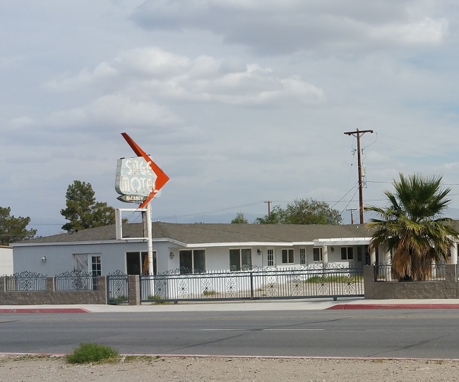
After a delicious meal I considered getting a room, since I'd spent every night in the car. A lot of the motels had flashing signs advertising rates as low as $38.95 per night, but the reviews on Yelp were all fairly negative. I drove past a few that had closed and now sat abandoned, so I made a mental note to explore them in the morning. I ended up parking at a truck stop for the night.

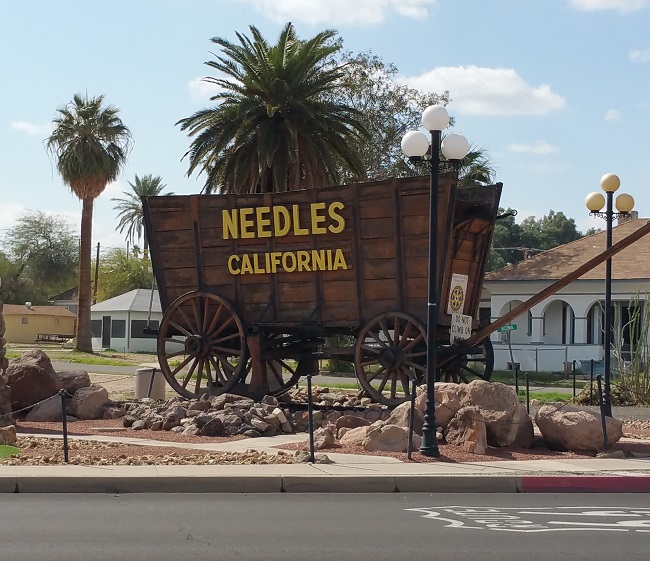
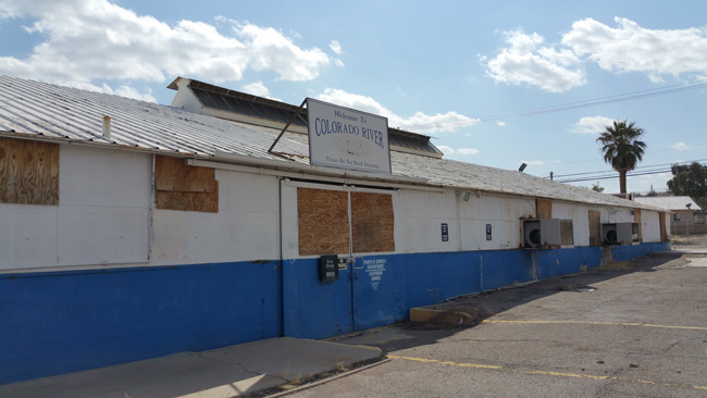
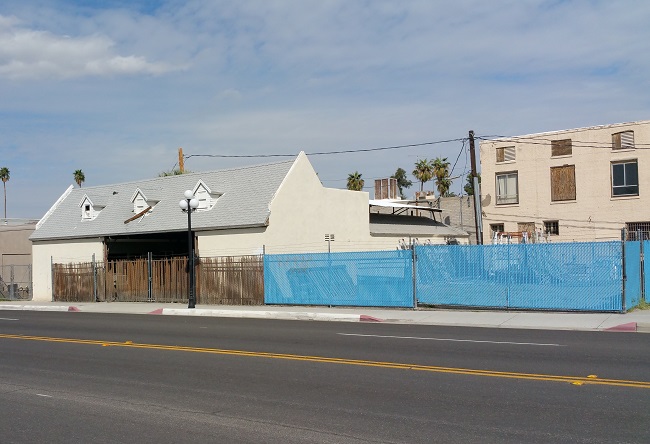
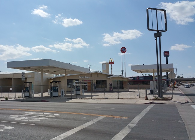
In the light of morning I got a better look at the city of Needles, and was astonished by the number of shuttered businesses.

Urban exploration of the dying town of Needles, CA along Route 66

Urban exploration of the dying town of Needles, CA along Route 66

Urban exploration of the dying town of Needles, CA along Route 66

Urban exploration of the dying town of Needles, CA along Route 66

Urban exploration of the dying town of Needles, CA along Route 66

Urban exploration of the dying town of Needles, CA along Route 66

Named for the nearby pointed mountain peaks, Needles was founded in 1883 to support the Atchison, Topeka and Santa Fe Railway. The city's location along the Western bank of the Colorado River, which serves as the California/Arizona border, was once its major draw. As in John Steinbeck's Grapes of Wrath, it was an important stopping point for travelers entering California in search of opportunity during the Dust Bowl era. Like the Joad family, thousands stopped in Needles for gas and supplies before crossing the Mojave Desert.

Its proximity to Arizona has since become a major factor behind the town's decline. With corporate taxes and building regulations being significantly higher in California, many large businesses such as Walmart, Kmart, and Home Depot have chosen to open stores in Bullhead City, AZ, only a 20-minute drive from Needles. And for savvy travelers who know that gas is often a dollar per gallon cheaper east of the Colorado River, the decision to stop for fuel and lunch in Bullhead City instead of Needles in a no-brainer.

Urban exploration of the dying town of Needles, CA along Route 66

Urban exploration of the dying town of Needles, CA along Route 66
Neat old Texaco station in Needles, CA

Urban exploration of the dying town of Needles, CA along Route 66

Other factors contributing to the decline of Needles include extremely high poverty (nearly 29% of the population lived below the poverty line at the time of the 2010 census), crime rates well above the national average (including violent crime), higher than average unemployment rates, and a lack of clothing and grocery stores. Also during summer months, Needles is often the hottest city in the United States, and sometimes the hottest on Earth.

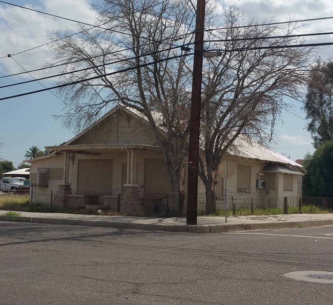
I spent hours walking around Needles, spotting vacant homes.

Urban exploration of the dying town of Needles, CA along Route 66

Urban exploration of the dying town of Needles, CA along Route 66

Urban exploration of the dying town of Needles, CA along Route 66

Urban exploration of the dying town of Needles, CA along Route 66

Urban exploration of the dying town of Needles, CA along Route 66

Urban exploration of the dying town of Needles, CA along Route 66

Urban exploration of the dying town of Needles, CA along Route 66

a shuttered burger joint,

Urban exploration of the dying town of Needles, CA along Route 66

a neat old theater with promotional signage for a movie that came out more than 4 years prior to my visit, 

Urban exploration of the dying town of Needles, CA along Route 66

Urban exploration of the dying town of Needles, CA along Route 66

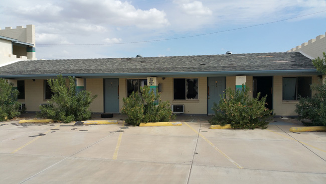
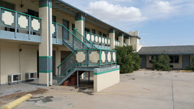
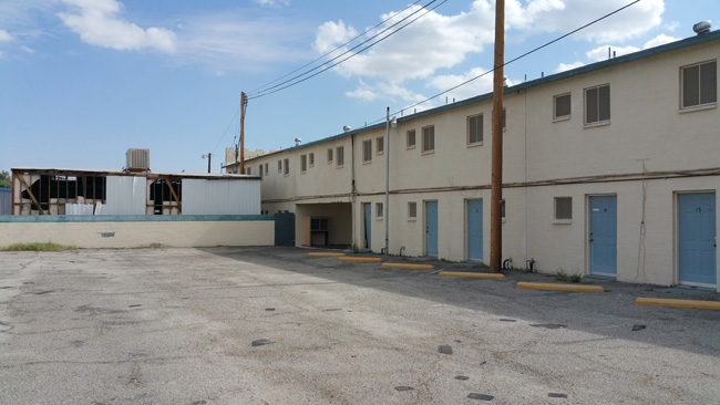
and quite a few abandoned motels.

Urban exploration of the dying town of Needles, CA along Route 66

Urban exploration of the dying town of Needles, CA along Route 66

Urban exploration of the dying town of Needles, CA along Route 66

Urban exploration of the dying town of Needles, CA along Route 66

Urban exploration of the dying town of Needles, CA along Route 66

Urban exploration of the dying town of Needles, CA along Route 66

Urban exploration of the dying town of Needles, CA along Route 66

Urban exploration of the dying town of Needles, CA along Route 66

One of the motels was not fenced off, so I had a quick peek inside. 

Urban exploration of the dying town of Needles, CA along Route 66

Urban exploration of the dying town of Needles, CA along Route 66

Urban exploration of the dying town of Needles, CA along Route 66

Urban exploration of the dying town of Needles, CA along Route 66

Urban exploration of the dying town of Needles, CA along Route 66

Urban exploration of the dying town of Needles, CA along Route 66

Urban exploration of the dying town of Needles, CA along Route 66

I was impressed to see very little graffiti anywhere in Needles. It is obvious that city officials are making an effort to keep their community free of such eyesores.

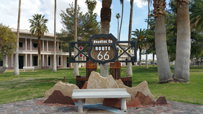
Needles has a small historic district that includes a well-manicured park,

Urban exploration of the dying town of Needles, CA along Route 66

Urban exploration of the dying town of Needles, CA along Route 66

and a museum and thrift store. 

Urban exploration of the dying town of Needles, CA along Route 66

After exploring Needes, I got back on the road and headed into Arizona, where I spent a crazy week exploring old minestrading posts, ghost towns, and many other very interesting abandonments. I even had a few run-ins with local law enforcement. 

I can't wait to tell you all about it!
Thanks for checking out this article. If you enjoyed it, please feel free to share it on Facebook. While you're at it, please subscribe to Places That Were and follow me on my social media sites:

Facebook: http://www.facebook.com/placesthatwere

Google+: https://plus.google.com/u/0/+JimSullivanPlacesThatWere/posts

EyeEm: https://www.eyeem.com/u/placesthatwere

Instagram: http://instagram.com/theplacesthatwere

Twitter: https://twitter.com/placesthatwere/

Tumblr: http://placesthatwere.tumblr.com/

Youtube: https://www.youtube.com/jimplicit

500px: https://500px.com/placesthatwere

Thank you!